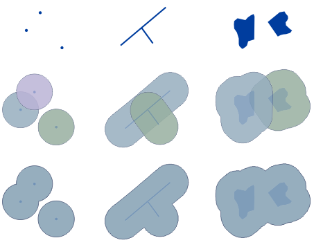
1
the fundamental purpose of geoprocessing is to provide tools and a framework for performing analysis and managing your geographic data
2
Computes a geometric intersection of the input features
3
Aggregates features based on specified attributes.
5
Combines multiple input datasets of the same data type into a single, new output dataset
7
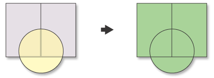
Use this tool to cut out a piece of one feature class using one or more of the features in another feature class as a cookie cutter